
Optics Mag is reader-supported. When you buy via links on our site, we may earn an affiliate commission at no cost to you. Read more.
How Is Satellite Imagery Used for Hurricanes? The Interesting Answer!
Last Updated on

More than 4,500 satellites are orbiting Earth and there are currently more than 400 of these satellites equipped with the capability to measure visible, infrared, and microwave waves. These satellite images were initially used for military purposes, but their uses have expanded over the decades.
For many, the best-known use of satellite imagery is via Google Earth. Google uses images gathered from satellites and planes and enables anybody to access visual data from almost anywhere on Earth. Satellite images are also used for weather tracking and prediction, including locating and predicting hurricanes and other major weather patterns.

About Hurricanes
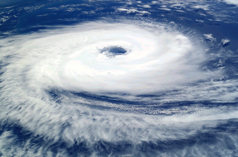
Typically, hurricanes form when several thunderstorms gather over the ocean. The storm gathers pace and power as it gets energy from the warm water and moist air. Because the warm air that is created rises, this carries moisture into the atmosphere where it rapidly cools and freezes and rain clouds are formed.
Where a closed circle of storms forms, storms become different classifications. When the winds travel at speeds of 39 miles per hour or more, the storm is classified as a tropical storm. Once the wind reaches 74 miles per hour, it is a hurricane. While many hurricanes will form and dissipate over the ocean without touching land, this isn’t always true. Hurricanes are considered the deadliest storms, and they can cause massive damage if they do reach land.
Most recently, Hurricane Katrina touched down in Louisiana and Mississippi, claiming the lives of nearly 2,000 people. Property damage was believed to have totaled more than $80 billion and will have a total cost of more than $150 billion for the area. It lasted 8 days and covered 90,000 square miles.
How Does Satellite Imagery Help?
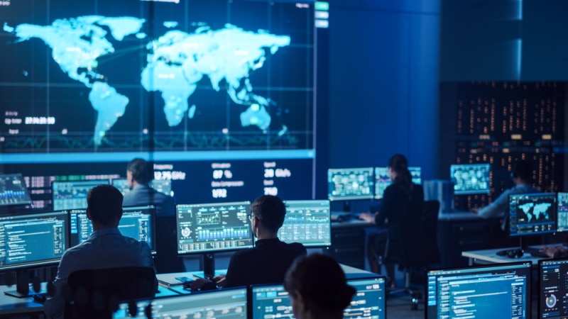
When predicting and tracking hurricanes, we often see the use of satellite imagery on weather forecasts and news reports. These aren’t just beneficial for informational purposes—they are used by meteorologists, the government, and other groups throughout the storm.
Storm Prediction and Mitigation
Some satellites can detect and record visual light. They effectively take photographs of the planet and its surroundings. Some are also capable of recording infrared and microwave activity and converting these into a visual representation. This enables the satellites to not only photograph clouds as they move, but also to determine temperature, wind speed, and other properties of the clouds.
Scientists can use that data to determine whether a particular storm will hit land, where it will hit, and how severe it will be. They can determine whether a cyclone will advance and become a hurricane or whether it will dissipate harmlessly.
This information is then used to formulate mitigation plans. If satellite imagery shows that a category 5 hurricane will hit populated land, storm warnings can be sounded, and residents can be moved to safety or encouraged to shore up defenses. Satellite imagery has undoubtedly saved lives thanks to its use in storm mitigation.
Storm Progress
Hurricanes typically last up to 24 hours but they can sustain themselves for as long as a month. Hurricane John is the longest recorded and most widely traveled hurricane. In 1994, it traveled more than 8,000 miles across the Pacific, lasting for 31 days. In that case, there were no fatalities as the hurricane barely touched land. More recently, Hurricane Jeanne took more than 3,000 lives during its 16-day course across the Bahamas and the Eastern United States.
Once a storm is underway, satellite imagery can be used to determine its progress. The imagery can indicate whether a reduction in wind temperature signifies the end of a storm or if the winds will pick back up again. It can also determine the likely direction and course of the hurricane. These predictions can help prevent further loss of life and damage.
Recovery
Once a hurricane has passed, satellite imagery is still useful because it photographs the affected area. It can be used to get a picture of the damage and destruction that a storm has caused. It might be able to give clues as to where assistance is required and where assistance is best sent. As well as assessing damage, the images can be used to formulate a recovery plan and to monitor and maintain that plan.


Final Thoughts
Satellite imagery has a variety of uses. It is used for military and humanitarian purposes. It is also used for meteorological applications, including the prediction and tracking of hurricanes. The satellites can gather visual and infrared data from the storms helping scientists predict the pattern and movement of existing hurricanes, too, and images can be used in the assessment of damage and the formulation of recovery plans.
Featured Image Credit: Andrey Armyagov, Shutterstock
About the Author Robert Sparks
Robert’s obsession with all things optical started early in life, when his optician father would bring home prototypes for Robert to play with. Nowadays, Robert is dedicated to helping others find the right optics for their needs. His hobbies include astronomy, astrophysics, and model building. Originally from Newark, NJ, he resides in Santa Fe, New Mexico, where the nighttime skies are filled with glittering stars.
Related Articles:
What Is the Best Binocular Magnification for Hunting? Optical Features Explained
Can You Use Binoculars to Look At Stars? How to Choose the Right Pair
How to Clean a Refractor Telescope: Step-by-Step Guide
How to Clean a Telescope Eyepiece: Step-by-Step Guide
How to Clean a Rifle Scope: 8 Expert Tips
Monocular vs Telescope: Differences Explained (With Pictures)
What Is a Monocular Used For? 8 Common Functions
How to Clean a Telescope Mirror: 8 Expert Tips